File:A464 Shifnal Bypass Interchange.png
Jump to navigation
Jump to search

No higher resolution available.
A464_Shifnal_Bypass_Interchange.png (600 × 464 pixels, file size: 51 KB, MIME type: image/png)
| |||||||||||||||||||||||||
File history
Click on a date/time to view the file as it appeared at that time.
| Date/Time | Thumbnail | Dimensions | User | Comment | |
|---|---|---|---|---|---|
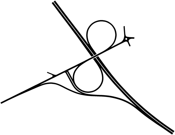
| current | 18:37, 31 July 2020 | | 600 × 464 (51 KB) | Truvelo (talk | contribs) | Junction of A464 and B4379, now A4169, as part of the Shifnal Bypass from the late 1960's. There is no southbound exit slip. Traffic would have to travel through the town to make this movement. |
File usage
The following 4 pages use this file: