File:A50 Meir tunnel - east portal - Geograph - 3268012.jpg
Jump to navigation
Jump to search

Size of this preview: 400 × 600 pixels. Other resolution: 427 × 640 pixels.
Original file (427 × 640 pixels, file size: 57 KB, MIME type: image/jpeg)
| |||||||||||||||||||||||||
|
Galleries | A50 | Meir Tunnel | Meir Interchange | ||
File history
Click on a date/time to view the file as it appeared at that time.
| Date/Time | Thumbnail | Dimensions | User | Comment | |
|---|---|---|---|---|---|
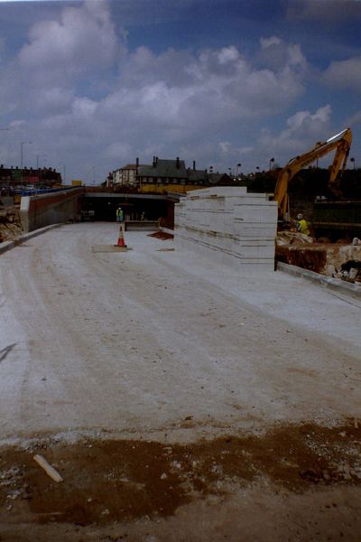
| current | 12:06, 1 June 2016 | | 427 × 640 (57 KB) | Jeni (talk | contribs) | '''A50 Meir tunnel - east portal''' Taken as part of a GCSE school project this photo shows the Meir tunnel under construction and the A50 upgrades in about 1997. |
File usage
The following page uses this file: