No higher resolution available.
File history
Click on a date/time to view the file as it appeared at that time.
| Date/Time | Thumbnail | Dimensions | User | Comment |
|---|
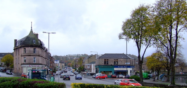
| current | 17:56, 21 February 2021 |  | 640 × 303 (101 KB) | Tam nugent (talk | contribs) | In the east end of Gourock, near the Greenock boundary. The roads are, from left to right, Manor Crescent, cardwell Road and Cove Road. |
File usage
The following 2 pages use this file:
This file contains additional information, probably added from the digital camera or scanner used to create or digitise it.
If the file has been modified from its original state, some details may not fully reflect the modified file.
