No higher resolution available.
File history
Click on a date/time to view the file as it appeared at that time.
| Date/Time | Thumbnail | Dimensions | User | Comment |
|---|
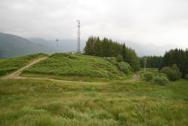
| current | 11:30, 7 July 2011 |  | 640 × 427 (118 KB) | Rileyrob (talk | contribs) | The end of the public road on Monument Hill (left of shot). It is hard to believe that this was once the A819! |
File usage
The following page uses this file:
This file contains additional information, probably added from the digital camera or scanner used to create or digitise it.
If the file has been modified from its original state, some details may not fully reflect the modified file.
