File:A828-Loch Creran - Coppermine - 11501.jpg
Jump to navigation
Jump to search

Size of this preview: 761 × 600 pixels. Other resolution: 1,280 × 1,009 pixels.
Original file (1,280 × 1,009 pixels, file size: 321 KB, MIME type: image/jpeg)
| |||||||||||||||||||||||||
|
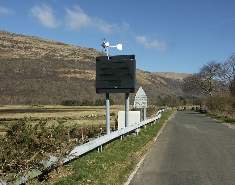
Galleries | A828 | Creagan Bridge | Vehicle activated signs | ||
File history
Click on a date/time to view the file as it appeared at that time.
| Date/Time | Thumbnail | Dimensions | User | Comment | |
|---|---|---|---|---|---|
| current | 18:33, 20 January 2010 | | 1,280 × 1,009 (321 KB) | Rileyrob (talk | contribs) | {{Information |description = '''A828 original route around Loch Creran''' The road used to flood at the head of Loch Creran if there was a combination of heavy rain and high tide. Traffic was diverted around up the drive to a private house at Druimavuich |
File usage
The following page uses this file: