 | |  |
| | Description: | The A928 halfway between Glamis and Kirriemuir, south of the hamlet of Roundyhill. | | Location: | 56.634571, -3.017051 | | Road: | A928 | | Date: | 01 04 2018 | | Photographer: | Scott Cormie | | Source: | |
|
|
| |
 | |  |
File history
Click on a date/time to view the file as it appeared at that time.
| Date/Time | Thumbnail | Dimensions | User | Comment |
|---|
| current | 11:19, 5 April 2018 | 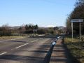 | 5,184 × 3,888 (876 KB) | Scotti (talk | contribs) | The A928 halfway between Glamis and Kirriemuir, south of the hamlet of Roundyhill. |
File usage
The following 2 pages use this file:
This file contains additional information, probably added from the digital camera or scanner used to create or digitise it.
If the file has been modified from its original state, some details may not fully reflect the modified file.

