File:A9 Road Bridge over the Balnagown River - Geograph - 6006309.jpg
Jump to navigation
Jump to search

No higher resolution available.
A9_Road_Bridge_over_the_Balnagown_River_-_Geograph_-_6006309.jpg (640 × 457 pixels, file size: 124 KB, MIME type: image/jpeg)
| |||||||||||||||||||||||||
|
Galleries | A9 | Balnagown Bridge | ||
File history
Click on a date/time to view the file as it appeared at that time.
| Date/Time | Thumbnail | Dimensions | User | Comment | |
|---|---|---|---|---|---|
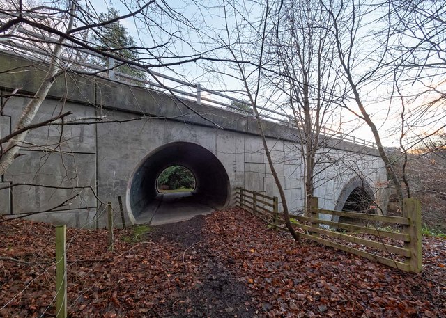
| current | 08:34, 20 May 2022 | | 640 × 457 (124 KB) | Rileyrob (talk | contribs) | '''A9 Road Bridge over the Balnagown River''' It is interesting that when this bridge was built, as well as an arch over the Balnagown River, a second arch was provided. This must have been due to the fact that this was the north driveway to the Earl of Cromartie's Tarbat House The driveway has its own arch through the Parkhill Railway Bridge as few yards further south [6006760] |
File usage
The following 2 pages use this file: