File:A 431 closed at Kelston February 2014 (C) Rick Crowley - Geograph - 3873227.jpg
Jump to navigation
Jump to search

No higher resolution available.
A_431_closed_at_Kelston_February_2014_(C)_Rick_Crowley_-_Geograph_-_3873227.jpg (640 × 428 pixels, file size: 81 KB, MIME type: image/jpeg)
| |||||||||||||||||||||||||
|
Galleries | A431 | Kelston Toll Road | Roadworks | ||
File history
Click on a date/time to view the file as it appeared at that time.
| Date/Time | Thumbnail | Dimensions | User | Comment | |
|---|---|---|---|---|---|
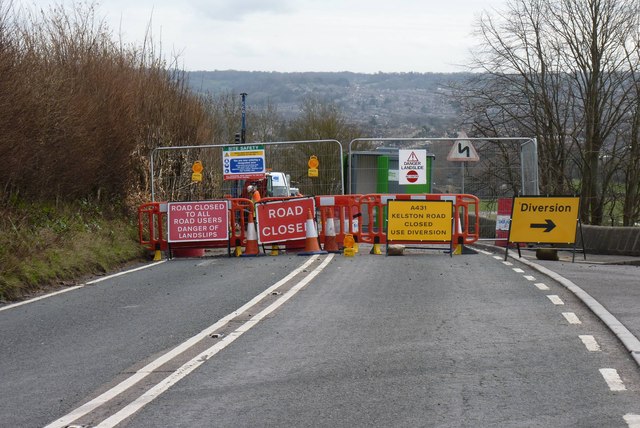
| current | 13:02, 5 August 2014 | | 640 × 428 (81 KB) | Si404 (talk | contribs) | '''A 431 closed at Kelston February 2014 (C) Rick Crowley '''<br/>During the rains in February the A431 road at Kelston, close to the Drive of Kelston Park, collapsed. Access to the Old Crown at Midford is possible from the Bristol end. Bus services an... |
File usage
The following 3 pages use this file:
_Rick_Crowley_-_Geograph_-_3873227.jpg&oldid=382925)