File:A view of the River Tees from Cliffe - Geograph - 1624410.jpg

From Roader's Digest: The SABRE Wiki
Jump to navigation Jump to search

A_view_of_the_River_Tees_from_Cliffe_-_Geograph_-_1624410.jpg(640 × 480 pixels, file size: 91 KB, MIME type: image/jpeg)

Y topleft.gifY topright.gif
Description:
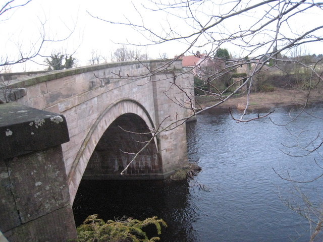
A view of the River Tees from Cliffe
This photograph shows the River Tees at Piercebridge as it flows from west to east in order to make its way to Teesmouth. The picture was taken from the Cliffe (south) side of the river looking north to the village of Piercebridge (on the opposite side of the river).
Location:54.535146, -1.674967
Road:B6275
Date:13 12 2009
Photographer:� Copyright Philip Barker and licensed for reuse under this Creative Commons Licence
Source:Geograph

Map

Y btmleft.gifY btmright.gif

Galleries  | B6275 | Pierce Bridge

File history

Click on a date/time to view the file as it appeared at that time.

Date/TimeThumbnailDimensionsUserComment
current17:27, 7 July 2010Thumbnail for version as of 17:27, 7 July 2010640 × 480 (91 KB)Bob@romiley1 (talk | contribs)'''A view of the River Tees from Cliffe'''<br/>This photograph shows the River Tees at Piercebridge as it flows from west to east in order to make its way to Teesmouth. The picture was taken from the Cliffe (south) side of the river looking north to the

The following 3 pages use this file:

Metadata

SABRE - The Society for All British and Irish Road Enthusiasts
Discuss - Digest - Discover - Help