File:Advance direction sign, Ballynabragget near Banbridge - Geograph - 3751180.jpg
Jump to navigation
Jump to search

No higher resolution available.
Advance_direction_sign,_Ballynabragget_near_Banbridge_-_Geograph_-_3751180.jpg (640 × 415 pixels, file size: 59 KB, MIME type: image/jpeg)
| |||||||||||||||||||||||||
|
Galleries | A26 (Northern Ireland) | Advance Direction Sign | Pictures from Geograph | ||
File history
Click on a date/time to view the file as it appeared at that time.
| Date/Time | Thumbnail | Dimensions | User | Comment | |
|---|---|---|---|---|---|
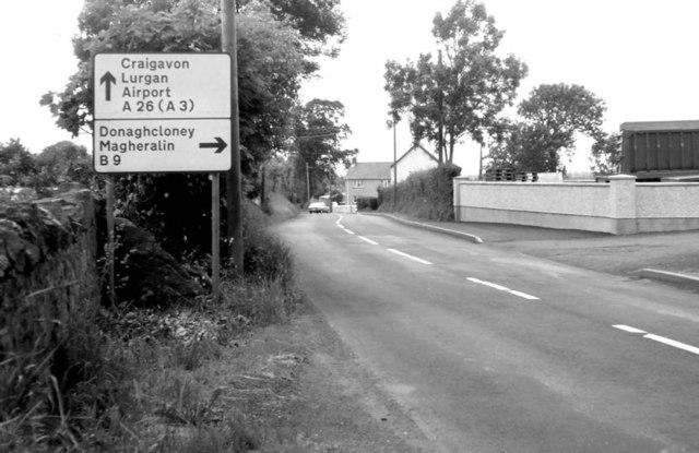
| current | 06:23, 3 September 2021 | | 640 × 415 (59 KB) | C2r (talk | contribs) | '''Advance direction sign, Ballynabragget near Banbridge''' This sign, on the Banbridge – Lurgan road, approaching the turn for Donaghacloney, had been a long-surviving “pre-Worboys”. When I finally got “around to it” I found that it had been replaced. |
File usage
There are no pages that use this file.