File:Allt a Chaorainn Bhig - Geograph - 466152.jpg
Jump to navigation
Jump to search

No higher resolution available.
Allt_a_Chaorainn_Bhig_-_Geograph_-_466152.jpg (640 × 459 pixels, file size: 52 KB, MIME type: image/jpeg)
| |||||||||||||||||||||||||
|
Galleries | A887 | A87 | Abandoned Road | ||
File history
Click on a date/time to view the file as it appeared at that time.
| Date/Time | Thumbnail | Dimensions | User | Comment | |
|---|---|---|---|---|---|
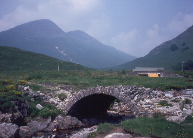
| current | 09:14, 19 August 2020 | | 640 × 459 (52 KB) | C2r (talk | contribs) | '''Allt a' Chaorainn Bhig''' Burn descending towards Loch Cluanie. The orange tent is a Force 10, the mountaineer's work horse of the 1970s and 1980s. The bridge arch from the old single track road (A887) down Glen Morriston is shown on maps as being beneath the loch - the grass tells a different story. The extent of Loch Cluanie is exaggerated by the Ordnance Survey. The bridge behind is the modern A87, constructed on a new alignment to the north of the reservoir |
File usage
The following page uses this file: