File:Approaching Neasden Junction (C) Jaggery - Geograph - 3072566.jpg
Jump to navigation
Jump to search

No higher resolution available.
Approaching_Neasden_Junction_(C)_Jaggery_-_Geograph_-_3072566.jpg (640 × 495 pixels, file size: 79 KB, MIME type: image/jpeg)
| |||||||||||||||||||||||||
|
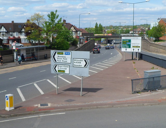
Galleries | A4088 | Neasden Junction | ||
File history
Click on a date/time to view the file as it appeared at that time.
| Date/Time | Thumbnail | Dimensions | User | Comment | |
|---|---|---|---|---|---|
| current | 19:57, 4 November 2013 | | 640 × 495 (79 KB) | Vlad (talk | contribs) | '''Approaching Neasden Junction (C) Jaggery '''<br/>A view along the A4088 from a footbridge. Ahead is the junction with the North Circular Road (A406). |
File usage
The following 3 pages use this file:
_Jaggery_-_Geograph_-_3072566.jpg&oldid=357772)