File:Athlone, County Westmeath - Geograph - 1808703.jpg

From Roader's Digest: The SABRE Wiki
Jump to navigation Jump to search

Athlone,_County_Westmeath_-_Geograph_-_1808703.jpg(640 × 428 pixels, file size: 54 KB, MIME type: image/jpeg)

Y topleft.gifY topright.gif
Description:
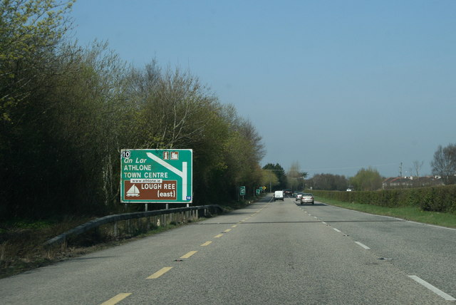
Athlone, County Westmeath
On the Athlone N6 bypass heading west. The road between Galway and the edge of Dublin is motorway except for the 10km Athlone bypass. A proposal by the National Roads Authority to reclassify it as motorway was refused because it is widely used by internal Athlone traffic avoiding the congested bridge in the town centre. In a fit of pique the NRA left the decrepit old signs in place and just slapped the new 'M6' exit numbers on them. There is none so bitter as a roads engineer scorned.
Location:53.429006, -7.918692
Road:N6
Date:16 04 2010
Photographer:© Copyright Sarah777 and licensed for reuse under this Creative Commons Licence
Source:Geograph

Map

Y btmleft.gifY btmright.gif

Galleries  | N6 | Athlone | Advance Direction Sign | Cloghanboy Junction

File history

Click on a date/time to view the file as it appeared at that time.

Date/TimeThumbnailDimensionsUserComment
current15:06, 16 June 2010Thumbnail for version as of 15:06, 16 June 2010640 × 428 (54 KB)Si404 (talk | contribs)'''Athlone, County Westmeath'''<br/>On the Athlone N6 bypass heading west. The road between Galway and the edge of Dublin is motorway except for the 10km Athlone bypass. A proposal by the National Roads Authority to reclassify it as motorway was refused b

Metadata

SABRE - The Society for All British and Irish Road Enthusiasts
Discuss - Digest - Discover - Help