File:B2051-1928.png
Jump to navigation
Jump to search

No higher resolution available.
B2051-1928.png (167 × 165 pixels, file size: 72 KB, MIME type: image/png)
| ||||||||||||||
|
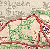
Galleries | B2051 (Westgate-on-Sea - Woodchurch) | Ten-Mile Road Map of Great Britain | ||
File history
Click on a date/time to view the file as it appeared at that time.
| Date/Time | Thumbnail | Dimensions | User | Comment | |
|---|---|---|---|---|---|
| current | 22:37, 4 May 2010 | | 167 × 165 (72 KB) | Steven (talk | contribs) | {{Information |description = B2051, Isle of Thanet |day = |month = |year = 1946 |photographer = |source = OS Ten-Mile Road Map of Great Britain, Sheet 2 |licence = none |road |
File usage
The following 4 pages use this file: