File:B4363 road at Kinlet, looking north - Geograph - 782465.jpg

From Roader's Digest: The SABRE Wiki
Jump to navigation Jump to search

B4363_road_at_Kinlet,_looking_north_-_Geograph_-_782465.jpg(640 × 480 pixels, file size: 118 KB, MIME type: image/jpeg)

Y topleft.gifY topright.gif
Description:
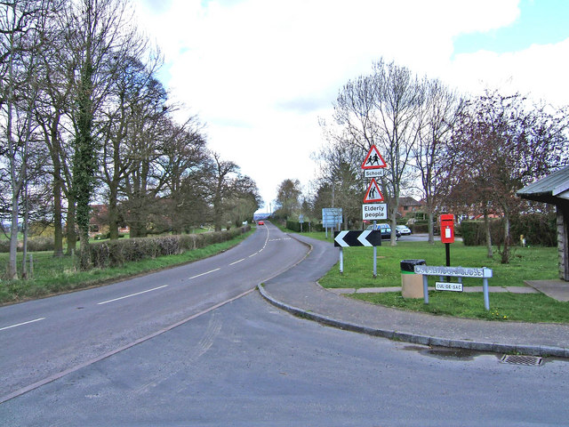
B4363 road at Kinlet, looking north
The B4363 road from Cleobury Mortimer to Bridgnorth passes through the very rural hamlet of Kinlet. This view is taken from just outside the Eagle & Serpent inn. Coming in from the right is a small cul-de-sac. Kinlet is also served by the B4194 from Bewdley which makes a junction with the B4363 behind the inn.
Location:52.419963, -2.414759
Road:B4363
Date:05 04 2008
Photographer:� Copyright P L Chadwick and licensed for reuse under this Creative Commons Licence
Source:Geograph

Map

Y btmleft.gifY btmright.gif

Galleries  | B4363 | Warning Sign/Children | S2 | Warning Sign/Pedestrians | Warning Sign/Sharp Deviation of Route

File history

Click on a date/time to view the file as it appeared at that time.

Date/TimeThumbnailDimensionsUserComment
current15:03, 15 March 2010Thumbnail for version as of 15:03, 15 March 2010640 × 480 (118 KB)Bob@romiley1 (talk | contribs)'''B4363 road at Kinlet, looking north'''<br/>The B4363 road from Cleobury Mortimer to Bridgnorth passes through the very rural hamlet of Kinlet. This view is taken from just outside the Eagle & Serpent inn. Coming in from the right is a small cul-de-sa

The following page uses this file:

Metadata

SABRE - The Society for All British and Irish Road Enthusiasts
Discuss - Digest - Discover - Help