No higher resolution available.
File history
Click on a date/time to view the file as it appeared at that time.
| Date/Time | Thumbnail | Dimensions | User | Comment |
|---|
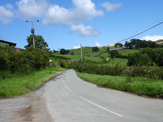
| current | 18:12, 16 March 2010 |  | 640 × 480 (93 KB) | Bob@romiley1 (talk | contribs) | '''B4392 above Cyfronydd'''<br/>Most of this area is rolling upland pasture, grazed by sheep or cattle. |
File usage
The following page uses this file:
This file contains additional information, probably added from the digital camera or scanner used to create or digitise it.
If the file has been modified from its original state, some details may not fully reflect the modified file.
