File:B4414 Merionethshire map.png
Jump to navigation
Jump to search

Size of this preview: 374 × 600 pixels. Other resolution: 436 × 699 pixels.
Original file (436 × 699 pixels, file size: 1.22 MB, MIME type: image/png)
| |||||||||||||||||||||||||
|
Galleries | B4414 (Merionethshire) | Blaenau Ffestiniog | OS One Inch | ||
File history
Click on a date/time to view the file as it appeared at that time.
| Date/Time | Thumbnail | Dimensions | User | Comment | |
|---|---|---|---|---|---|
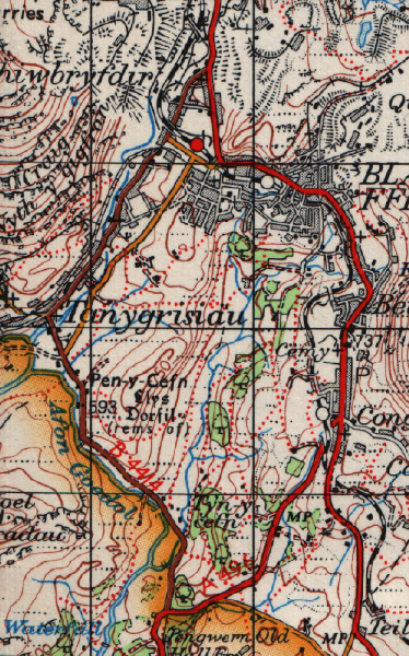
| current | 19:00, 20 January 2010 | | 436 × 699 (1.22 MB) | Ritchie333 (talk | contribs) | {{Information |description = B4414 near Blaenau Ffestiniog |day = |month = |year = 1962 |photographer = Ordnance Survey Seventh Series Sheet 116 |source = |road = B4414 |road2 = |road3 = |lat |
File usage
The following 3 pages use this file: