File:B53-R282 (C) Richard Webb - Geograph - 3266599.jpg

From Roader's Digest: The SABRE Wiki
Jump to navigation Jump to search

B53-R282_(C)_Richard_Webb_-_Geograph_-_3266599.jpg(640 × 480 pixels, file size: 304 KB, MIME type: image/jpeg)

Y topleft.gifY topright.gif
Description:
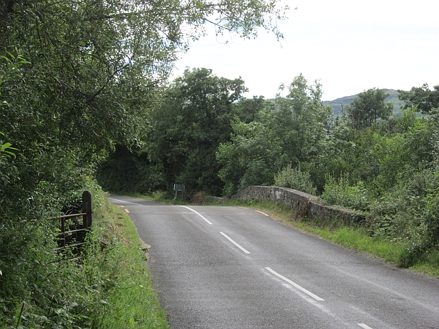
B53-R282 (C) Richard Webb
The road markings change at the border which is on the bridge. This was my 8th and final crossing of the day. Ahead are the hills of Co. Leitrim which turned out to be every bit as lovely as I remembered them from my last visit, but this of course meant a pass had to be crossed. Engage low gear!
Location:54.405229, -8.096528
Road:B53 (Garrison - Rossinver), R282
Date:20 07 2012
Photographer:Richard Webb and licensed for reuse under this Creative Commons Licence
Source:Geograph

Map

Y btmleft.gifY btmright.gif

Galleries  | B53 (Garrison - Rossinver) | R282

File history

Click on a date/time to view the file as it appeared at that time.

Date/TimeThumbnailDimensionsUserComment
current23:01, 11 November 2013Thumbnail for version as of 23:01, 11 November 2013640 × 480 (304 KB)Vlad (talk | contribs)'''B53-R282 (C) Richard Webb '''<br/>The road markings change at the border which is on the bridge. This was my 8th and final crossing of the day. Ahead are the hills of Co. Leitrim which turned out to be every bit as lovely as I remembered them from m...

Metadata

SABRE - The Society for All British and Irish Road Enthusiasts
Discuss - Digest - Discover - Help