File:B9163 at Shore Mill - Geograph - 2718805.jpg
Jump to navigation
Jump to search

No higher resolution available.
B9163_at_Shore_Mill_-_Geograph_-_2718805.jpg (640 × 428 pixels, file size: 49 KB, MIME type: image/jpeg)
| |||||||||||||||||||||||||
|
Galleries | B9163 | ||
File history
Click on a date/time to view the file as it appeared at that time.
| Date/Time | Thumbnail | Dimensions | User | Comment | |
|---|---|---|---|---|---|
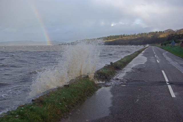
| current | 20:43, 10 January 2017 | | 640 × 428 (49 KB) | Vlad (talk | contribs) | '''B9163 at Shore Mill''' The B9163 runs along the north shore of the Black Isle coming very close to the water at Shore Mill - a little too close on this day when high winds and a high tide are causing waves to break over the road. |
File usage
The following page uses this file: