File:Bardill's Island near Stapleford (from the west) - Geograph - 620807.jpg

From Roader's Digest: The SABRE Wiki
Jump to navigation Jump to search

Bardill's_Island_near_Stapleford_(from_the_west)_-_Geograph_-_620807.jpg(632 × 470 pixels, file size: 95 KB, MIME type: image/jpeg)

Y topleft.gifY topright.gif
Description:
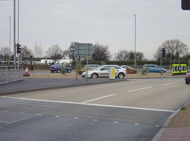
Bardill's Island near Stapleford (from the west)
This is where the main A52 (Nottingham - Derby) crosses the Stapleford to Toton and Chilwell Road. The roundabout has been completely rebuilt recently to provide a direct link for eastbound traffic off the A52 towards Toton.
Location:52.919865, -1.265234
Road:A52, B6003
Date:25 11 2007
Photographer:� Copyright Alan Murray-Rust and licensed for reuse under this Creative Commons Licence
Source:Geograph

Map

Y btmleft.gifY btmright.gif

Galleries  | A52 | B6003 | Bardills Roundabout

File history

Click on a date/time to view the file as it appeared at that time.

Date/TimeThumbnailDimensionsUserComment
current14:38, 5 October 2010Thumbnail for version as of 14:38, 5 October 2010632 × 470 (95 KB)Bob@romiley1 (talk | contribs)'''Bardill's Island near Stapleford (from the west)'''<br/>This is where the main A52 (Nottingham - Derby) crosses the Stapleford to Toton and Chilwell Road. The roundabout has been completely rebuilt recently to provide a direct link for eastbound traffi

Metadata

SABRE - The Society for All British and Irish Road Enthusiasts
Discuss - Digest - Discover - Help