File:Bas+Plans+6.jpg
Jump to navigation
Jump to search
Size of this preview: 764 × 600 pixels. Other resolution: 2,504 × 1,965 pixels.
Original file (2,504 × 1,965 pixels, file size: 937 KB, MIME type: image/jpeg)
| ||||||||||||||
|
Galleries | A30 | A339 | A33 | Basingstoke | Black Dam Roundabout | Brighton Hill Roundabout | Hackwood Road Roundabout | Hatch Warren Roundabout | Kempshott Roundabout | ||
File history
Click on a date/time to view the file as it appeared at that time.
| Date/Time | Thumbnail | Dimensions | User | Comment | |
|---|---|---|---|---|---|
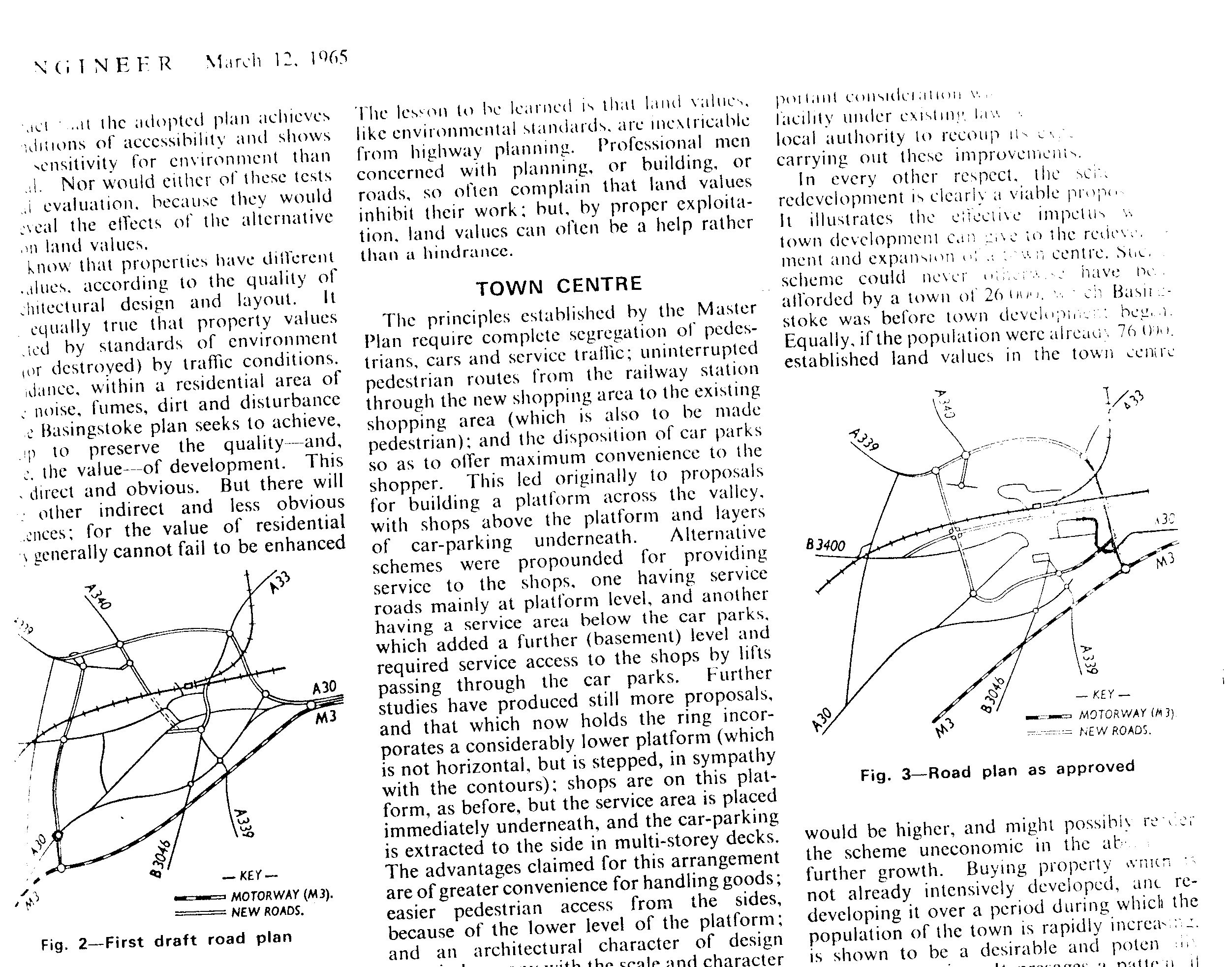
| current | 18:01, 2 May 2012 | | 2,504 × 1,965 (937 KB) | Stevea30 (talk | contribs) | Plans for the redevelopment of Basingstoke roads as part of the London Overspill, as it was called then. |
File usage
The following 6 pages use this file: