File:Belvelly Bridge, Belvelly Townland - Geograph - 1901896.jpg

From Roader's Digest: The SABRE Wiki
Jump to navigation Jump to search

Belvelly_Bridge,_Belvelly_Townland_-_Geograph_-_1901896.jpg(640 × 480 pixels, file size: 68 KB, MIME type: image/jpeg)

Y topleft.gifY topright.gif
Description:
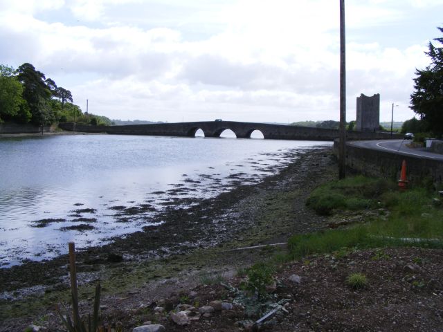
Belvelly Bridge, Belvelly Townland This bridge is the only fixed access onto Great Island, where Cobh is the major town. The other end of the bridge goes onto Fota Island before crossing another bridge onto the main land near the N25. There is also the Cross River vehicle and passenger ferry between Rushbrook and Passage West.
Location:51.889326, -8.306093
Road:R624
Date:01 06 2010
Photographer:(c) Copyright Mac McCarron and licensed for reuse under this Creative Commons Licence
Source:Geograph

Map

Y btmleft.gifY btmright.gif

Galleries  | R624 | Bridges | Belvelly Bridge | County Cork

File history

Click on a date/time to view the file as it appeared at that time.

Date/TimeThumbnailDimensionsUserComment
current17:45, 28 May 2016Thumbnail for version as of 17:45, 28 May 2016640 × 480 (68 KB)A39 chris (talk | contribs)'''Belvelly Bridge, Belvelly Townland''' This bridge is the only fixed access onto Great Island, where Cobh is the major town. The other end of the bridge goes onto Fota Island before crossing another bridge onto the main land near the N25. There is al...

The following page uses this file:

Metadata

SABRE - The Society for All British and Irish Road Enthusiasts
Discuss - Digest - Discover - Help