File:Border Counties Railway (C) Peter McDermott - Geograph - 1273025.jpg
Jump to navigation
Jump to search

No higher resolution available.
Border_Counties_Railway_(C)_Peter_McDermott_-_Geograph_-_1273025.jpg (640 × 368 pixels, file size: 92 KB, MIME type: image/jpeg)
| |||||||||||||||||||||||||
|
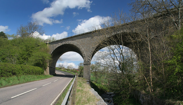
Galleries | A6079 | ||
File history
Click on a date/time to view the file as it appeared at that time.
| Date/Time | Thumbnail | Dimensions | User | Comment | |
|---|---|---|---|---|---|
| current | 17:34, 2 November 2014 | | 640 × 368 (92 KB) | Vlad (talk | contribs) | '''Border Counties Railway (C) Peter McDermott '''<br/>Elegant masonry skew arch bridge carrying the Border Counties Railway across the A6079 and Erring Burn near Chollerton. |
File usage
The following page uses this file:
_Peter_McDermott_-_Geograph_-_1273025.jpg&oldid=390269)