 | |  |
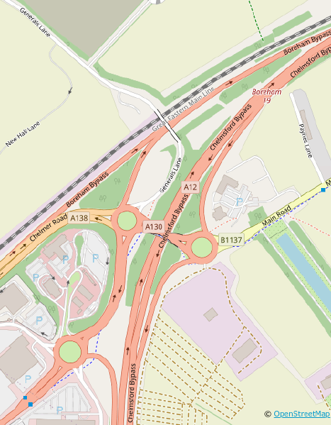
| | Description: | Boreham Interchange Map in 2021 prior to works (Copyright Openstreetmap and Contributors) | | Location: | 51.756345, 0.521662 | | Road: | | | Date: | 30 01 2021 | | Photographer: | | | Source: | |
|
|
| |
 | |  |
File history
Click on a date/time to view the file as it appeared at that time.
| Date/Time | Thumbnail | Dimensions | User | Comment |
|---|
| current | 10:52, 30 January 2021 | 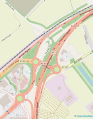 | 499 × 640 (124 KB) | C2r (talk | contribs) | Boreham Interchange Map in 2021 prior to works (Copyright Openstreetmap and Contributors) |
File usage
The following page uses this file:
This file contains additional information, probably added from the digital camera or scanner used to create or digitise it.
If the file has been modified from its original state, some details may not fully reflect the modified file.
