File:Boundary stone, Moor Lane B6107, Meltham - Geograph - 1112962.jpg
Jump to navigation
Jump to search

No higher resolution available.
Boundary_stone,_Moor_Lane_B6107,_Meltham_-_Geograph_-_1112962.jpg (640 × 476 pixels, file size: 119 KB, MIME type: image/jpeg)
| |||||||||||||||||||||||||
|
Galleries | B6107 | Milestones | S2 | ||
File history
Click on a date/time to view the file as it appeared at that time.
| Date/Time | Thumbnail | Dimensions | User | Comment | |
|---|---|---|---|---|---|
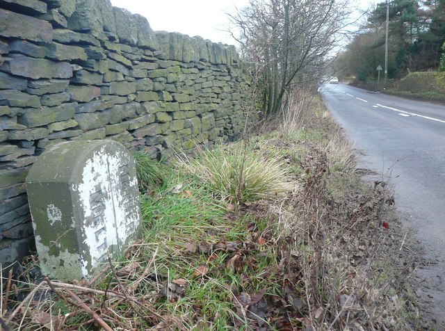
| current | 18:52, 1 April 2010 | | 640 × 476 (119 KB) | Bob@romiley1 (talk | contribs) | '''Boundary stone, Moor Lane B6107, Meltham'''<br/>This was probably set up soon after the formation of Urban District Councils in 1894. Netherthong UDC lasted only until 1912, when it became part of Holmfirth UDC. |
File usage
The following 2 pages use this file: