File:Boxworth- Cuckoo Pastures Farmhouse - Geograph - 4692242.jpg
Jump to navigation
Jump to search

No higher resolution available.
Boxworth-_Cuckoo_Pastures_Farmhouse_-_Geograph_-_4692242.jpg (640 × 526 pixels, file size: 120 KB, MIME type: image/jpeg)
| |||||||||||||||||||||||||
|
Galleries | C184 (Cambridgeshire) | Cambridgeshire | ||
File history
Click on a date/time to view the file as it appeared at that time.
| Date/Time | Thumbnail | Dimensions | User | Comment | |
|---|---|---|---|---|---|
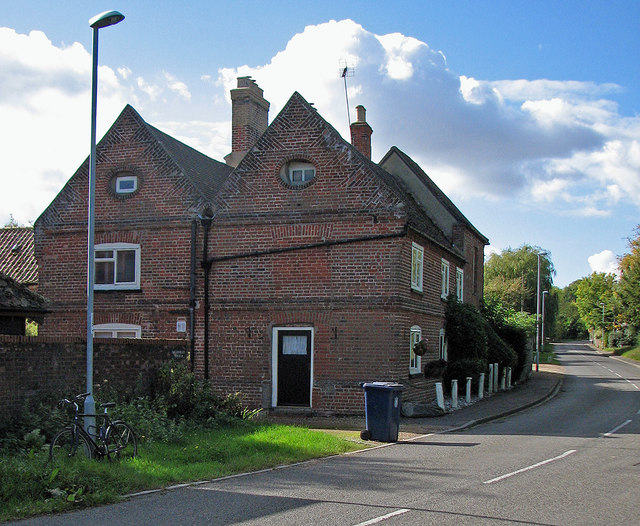
| current | 07:43, 23 March 2018 | | 640 × 526 (120 KB) | C2r (talk | contribs) | '''Boxworth- Cuckoo Pastures Farmhouse''' An M-roof with brick-tumbled gables and distinctive oval windows. It is Grade II listed: http://www.britishlistedbuildings.co.uk/en-50923-cuckoo-pastures-farmhouse-boxworth-cambri#.VheVwiiwHZY . |
File usage
The following 2 pages use this file: