File:Bridge over the flooding Usk - Geograph - 654502.jpg

From Roader's Digest: The SABRE Wiki
Jump to navigation Jump to search

Original file(480 × 640 pixels, file size: 118 KB, MIME type: image/jpeg)

Y topleft.gifY topright.gif
Description:
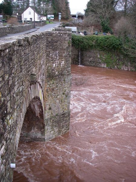
Bridge over the flooding Usk
The B4558 crosses the River Usk here south of Groesffordd - one of several of a similar style which span the river between Brecon and Abergavenny. The rich brown colour of these swollen waters reflect the soils and underlying geology of the upper Usk catchment which is almost wholly Old Red Sandstone rocks.
Location:51.936711, -3.343414
Road:B4558
Date:10 01 2008
Photographer:� Copyright Alan Bowring and licensed for reuse under this Creative Commons Licence
Source:Geograph

Map

Y btmleft.gifY btmright.gif

Galleries  | B4558 | Lock Bridge

File history

Click on a date/time to view the file as it appeared at that time.

Date/TimeThumbnailDimensionsUserComment
current15:00, 13 August 2010Thumbnail for version as of 15:00, 13 August 2010480 × 640 (118 KB)Bob@romiley1 (talk | contribs)'''Bridge over the flooding Usk'''<br/>The B4558 crosses the River Usk here south of Groesffordd - one of several of a similar style which span the river between Brecon and Abergavenny. The rich brown colour of these swollen waters reflect the soils and u

The following 2 pages use this file:

Metadata

SABRE - The Society for All British and Irish Road Enthusiasts
Discuss - Digest - Discover - Help