File:BridgewaterInterchangeDirectionalT.png
Jump to navigation
Jump to search

Size of this preview: 800 × 546 pixels. Other resolution: 1,117 × 763 pixels.
Original file (1,117 × 763 pixels, file size: 309 KB, MIME type: image/png)
| |||||||||||||||||||||||||
|
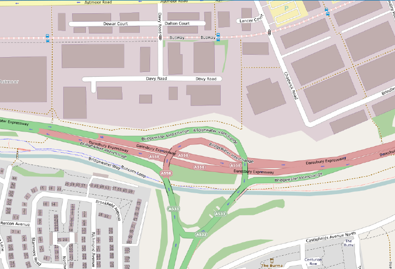
Galleries | A533 | Bridgewater Interchange | Runcorn | A558 | Mersey Gateway Bridge | ||
File history
Click on a date/time to view the file as it appeared at that time.
| Date/Time | Thumbnail | Dimensions | User | Comment | |
|---|---|---|---|---|---|
| current | 08:42, 3 March 2021 | | 1,117 × 763 (309 KB) | C2r (talk | contribs) | The Bridgewater Interchange as a Directional T,prior to the construction of the Mersey Gateway Bridge in the 2010s (c) Openstreetmap Contributors |
File usage
The following 6 pages use this file: