No higher resolution available.
File history
Click on a date/time to view the file as it appeared at that time.
| Date/Time | Thumbnail | Dimensions | User | Comment |
|---|
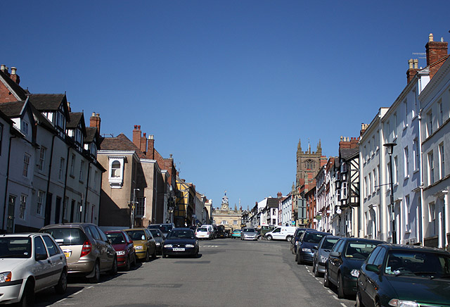
| current | 06:53, 22 June 2016 |  | 640 × 436 (96 KB) | M4simon (talk | contribs) | '''Broad Street, Ludlow''' Looking up the street towards the Buttercross with the tower of St Laurence's Church prominent. In 1923 this was the A49 |
File usage
The following 2 pages use this file:
This file contains additional information, probably added from the digital camera or scanner used to create or digitise it.
If the file has been modified from its original state, some details may not fully reflect the modified file.
