File:Camelford Station, north Cornwall - Geograph - 1285136.jpg
Jump to navigation
Jump to search

No higher resolution available.
Camelford_Station,_north_Cornwall_-_Geograph_-_1285136.jpg (538 × 600 pixels, file size: 118 KB, MIME type: image/jpeg)
| |||||||||||||||||||||||||
|
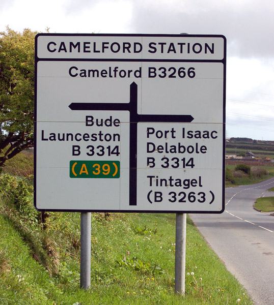
Galleries | B3266 | Advance Direction Sign | Camelford Station | ||
File history
Click on a date/time to view the file as it appeared at that time.
| Date/Time | Thumbnail | Dimensions | User | Comment | |
|---|---|---|---|---|---|
| current | 15:39, 31 January 2010 | | 538 × 600 (118 KB) | Jeni (talk | contribs) | {{Information |description = Camelford Station, north Cornwall |day = 30 |month = 04 |year = 2009 |photographer = © Copyright [http://www.geograph.org.uk/profile/32299 Andy F] and licensed for reuse under [http://creativecommons. |
File usage
The following 2 pages use this file: