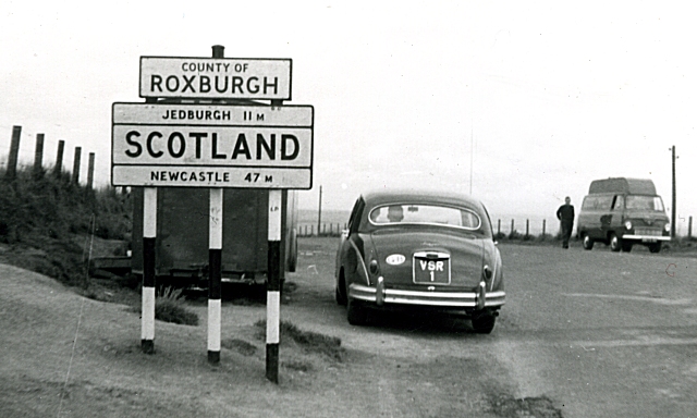
File:Carter Bar, 1960 - Geograph - 1279830.jpg
Jump to navigation
Jump to search

No higher resolution available.
Carter_Bar,_1960_-_Geograph_-_1279830.jpg (640 × 384 pixels, file size: 143 KB, MIME type: image/jpeg)
| |||||||||||||||||||||||||
|
Galleries | A68 | Pre-Worboys Information Signs | Border Crossing Point | Carter Bar | ||
File history
Click on a date/time to view the file as it appeared at that time.
| Date/Time | Thumbnail | Dimensions | User | Comment | |
|---|---|---|---|---|---|
| current | 21:52, 6 September 2009 | | 640 × 384 (143 KB) | Jeni (talk | contribs) | {{Information |description = Carter Bar, 1960 |day = |month = |year = 1960 |photographer = © Copyright [http://www.geograph.org.uk/profile/139 Anne Burgess] and licensed for reuse under [http://creativecommons.org/licenses/by-s |
File usage
The following 7 pages use this file: