File:Churchbridge BNRR 1988.png
Jump to navigation
Jump to search

No higher resolution available.
Churchbridge_BNRR_1988.png (600 × 320 pixels, file size: 57 KB, MIME type: image/png)
| |||||||||||||||||||||||||
|
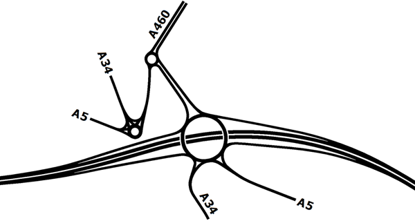
Galleries | A446(M) | A5 | A34 | Churchbridge | ||
File history
Click on a date/time to view the file as it appeared at that time.
| Date/Time | Thumbnail | Dimensions | User | Comment | |
|---|---|---|---|---|---|
| current | 20:03, 14 January 2020 | | 600 × 320 (57 KB) | Truvelo (talk | contribs) | Planned layout for Churchbridge as part of the BNRR proposals from 1987-1988. The design changed when the scheme was to be a toll road as roundabout junctions aren't ideal for tolling. |
File usage
The following 4 pages use this file: