File:City of London, 1983- westward on Holborn Viaduct - Geograph - 4644482.jpg
Jump to navigation
Jump to search

No higher resolution available.
City_of_London,_1983-_westward_on_Holborn_Viaduct_-_Geograph_-_4644482.jpg (640 × 360 pixels, file size: 76 KB, MIME type: image/jpeg)
| |||||||||||||||||||||||||
|
Galleries | A40 | ||
File history
Click on a date/time to view the file as it appeared at that time.
| Date/Time | Thumbnail | Dimensions | User | Comment | |
|---|---|---|---|---|---|
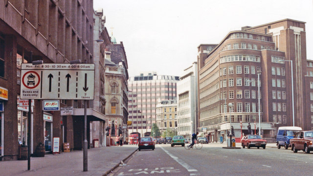
| current | 23:14, 8 April 2020 | | 640 × 360 (76 KB) | Bryn666 (talk | contribs) | '''City of London, 1983- westward on Holborn Viaduct''' We are outside Holborn Viaduct Station (BR/SR), which closed in 1988, on the main east-west road (A40) approaching Holborn Circus. |
File usage
The following 2 pages use this file: