File:Claverton Street, Widcombe - Geograph - 978437.jpg

From Roader's Digest: The SABRE Wiki
Jump to navigation Jump to search

Original file(428 × 640 pixels, file size: 72 KB, MIME type: image/jpeg)

Y topleft.gifY topright.gif
Description:
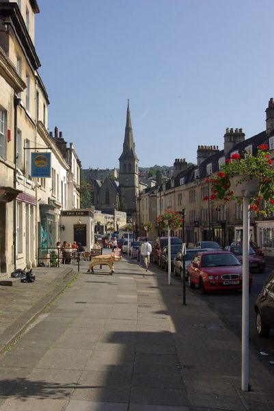
Claverton Street, Widcombe before the junctionw as redesigned. This busy thoroughfare in Bath is lined with small shops. Street names here are somewhat confusing: although shown as Claverton Street on street maps, businesses on the left hand side give their address as Claverton Buildings, and those on the right as Widcombe Parade. St Matthew's Church, built in Victorian times, can be seen ahead.
Location:51.376856, -2.354540
Road:A36, A3062
Date:20 09 2008
Photographer:(c) Copyright Stephen McKay and licensed for reuse under this Creative Commons Licence
Source:Geograph

Map

Y btmleft.gifY btmright.gif

Galleries  | A36 | A3062 | Widcombe Parade | Bath

File history

Click on a date/time to view the file as it appeared at that time.

Date/TimeThumbnailDimensionsUserComment
current14:37, 11 August 2016Thumbnail for version as of 14:37, 11 August 2016428 × 640 (72 KB)Rileyrob (talk | contribs)'''Claverton Street, Widcombe''' before the junctionw as redesigned. This busy thoroughfare in Bath is lined with small shops. Street names here are somewhat confusing: although shown as Claverton Street on street maps, businesses on the left hand side...

The following 2 pages use this file:

SABRE - The Society for All British and Irish Road Enthusiasts
Discuss - Digest - Discover - Help