File:Cobham Bridge - Geograph - 1141079.jpg

From Roader's Digest: The SABRE Wiki
Jump to navigation Jump to search

Cobham_Bridge_-_Geograph_-_1141079.jpg(640 × 480 pixels, file size: 89 KB, MIME type: image/jpeg)

Y topleft.gifY topright.gif
Description:
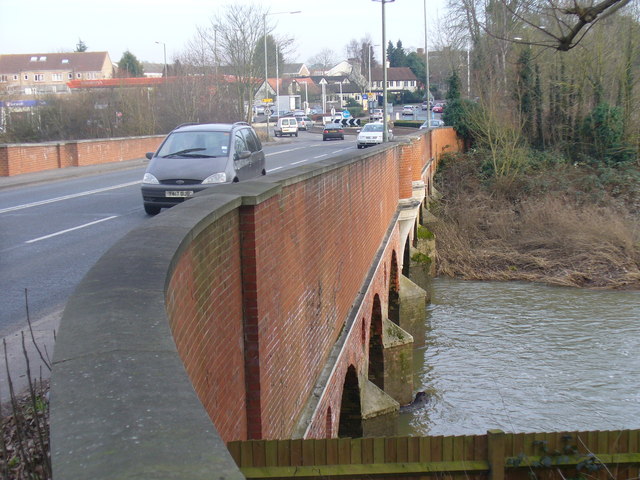
Cobham Bridge
Widened and strengthened road bridge carrying the Portsmouth Road across the River Mole between the A3 and Cobham. The latest bridge was built in 1782, designed by Surrey County Surveyor, George Gwilt. A previous bridge was built in 1351.
Location:51.333072, -0.423719
Road:A245
Date:31 01 2009
Photographer:� Copyright Colin Smith and licensed for reuse under this Creative Commons Licence
Source:Geograph

Map

Y btmleft.gifY btmright.gif

Galleries  | A245 | S2

File history

Click on a date/time to view the file as it appeared at that time.

Date/TimeThumbnailDimensionsUserComment
current17:04, 30 May 2010Thumbnail for version as of 17:04, 30 May 2010640 × 480 (89 KB)Bob@romiley1 (talk | contribs)'''Cobham Bridge'''<br/>Widened and strengthened road bridge carrying the Portsmouth Road across the River Mole between the A3 and Cobham. The latest bridge was built in 1782, designed by Surrey County Surveyor, George Gwilt. A previous bridge was built i

The following page uses this file:

Metadata

SABRE - The Society for All British and Irish Road Enthusiasts
Discuss - Digest - Discover - Help