File:Conor Hill Road takes a sharp right - Geograph - 3312360.jpg
Jump to navigation
Jump to search

No higher resolution available.
Conor_Hill_Road_takes_a_sharp_right_-_Geograph_-_3312360.jpg (640 × 436 pixels, file size: 60 KB, MIME type: image/jpeg)
| |||||||||||||||||||||||||
|
Galleries | R560 | Wild Atlantic Way | Conor Pass | ||
File history
Click on a date/time to view the file as it appeared at that time.
| Date/Time | Thumbnail | Dimensions | User | Comment | |
|---|---|---|---|---|---|
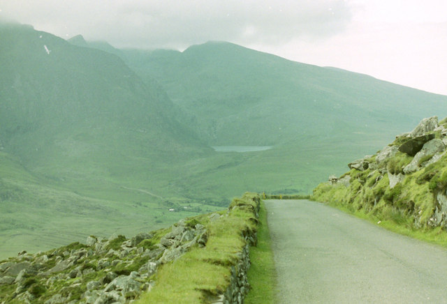
| current | 08:59, 14 May 2016 | | 640 × 436 (60 KB) | C2r (talk | contribs) | '''Conor Hill Road takes a sharp right''' With the R560 it's always a toss-up between watching the road or the scenery. The Brandon Mountain is in the distance. Many thanks to IanMT for his help on these speculative uploads. |
File usage
The following 3 pages use this file: