File:Corner of Blackfriars Road and The Cut, SE1 - Geograph - 470886.jpg

From Roader's Digest: The SABRE Wiki
Jump to navigation Jump to search

Corner_of_Blackfriars_Road_and_The_Cut,_SE1_-_Geograph_-_470886.jpg(640 × 480 pixels, file size: 102 KB, MIME type: image/jpeg)

Y topleft.gifY topright.gif
Description:
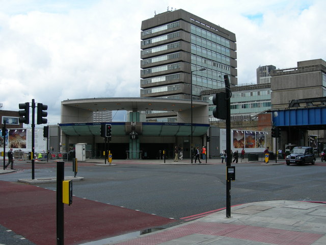
Corner of Blackfriars Road and The Cut, SE1
Showing Southwark Underground Station (this entrance is about 150 metres from the logo on the OS map). The railway bridge behind has no connection with the station here, it is an overground line out of Charing Cross.
Location:51.503879, -0.104584
Road:A201, B300
Date:18 06 2007
Photographer:� Copyright Danny Robinson and licensed for reuse under this Creative Commons Licence
Source:Geograph

Map

Y btmleft.gifY btmright.gif

Galleries  | A201 | B300 | Central London

File history

Click on a date/time to view the file as it appeared at that time.

Date/TimeThumbnailDimensionsUserComment
current18:08, 27 July 2010Thumbnail for version as of 18:08, 27 July 2010640 × 480 (102 KB)Si404 (talk | contribs)'''Corner of Blackfriars Road and The Cut, SE1'''<br/>Showing Southwark Underground Station (this entrance is about 150 metres from the logo on the OS map). The railway bridge behind has no connection with the station here, it is an overground line out of

The following page uses this file:

Metadata

SABRE - The Society for All British and Irish Road Enthusiasts
Discuss - Digest - Discover - Help