File:Corran-closed-signs.jpg
Jump to navigation
Jump to search

Size of this preview: 583 × 600 pixels. Other resolution: 622 × 640 pixels.
Original file (622 × 640 pixels, file size: 166 KB, MIME type: image/jpeg)
| |||||||||||||||||||||||||
|
Galleries | A82/Ballachulish - Fort William | Variable Message Sign | ||
File history
Click on a date/time to view the file as it appeared at that time.
| Date/Time | Thumbnail | Dimensions | User | Comment | |
|---|---|---|---|---|---|
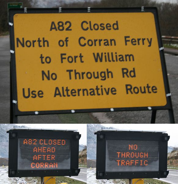
| current | 16:58, 10 December 2011 | | 622 × 640 (166 KB) | Rileyrob (talk | contribs) | The warning signs at Glencoe / Ballachulish during the closure of the A82 at Corran Ferry for removal of dangerous rock above roadway. |
File usage
There are no pages that use this file.