File:Croesfan newydd Merllyn New crossing (C) Alan Fryer - Geograph - 2586701.jpg
Jump to navigation
Jump to search

No higher resolution available.
Croesfan_newydd_Merllyn_New_crossing_(C)_Alan_Fryer_-_Geograph_-_2586701.jpg (640 × 480 pixels, file size: 48 KB, MIME type: image/jpeg)
| |||||||||||||||||||||||||
|
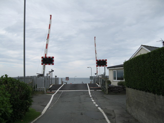
Galleries | Level Crossing | ||
File history
Click on a date/time to view the file as it appeared at that time.
| Date/Time | Thumbnail | Dimensions | User | Comment | |
|---|---|---|---|---|---|
| current | 16:46, 26 October 2013 | | 640 × 480 (48 KB) | Glen (talk | contribs) | '''Croesfan newydd Merllyn New crossing (C) Alan Fryer '''<br/>As part of the upgrading of the Cambrian line the manually operated crossing gates <a href="http://www.geograph.org.uk/photo/476753">SH5038 : Croesfan yng Nghricieth - Level crossing in Cri... |
File usage
The following page uses this file:
_Alan_Fryer_-_Geograph_-_2586701.jpg&oldid=355961)