File:Crummock Water and Mellbreak - Geograph - 1659664.jpg
Jump to navigation
Jump to search

No higher resolution available.
Crummock_Water_and_Mellbreak_-_Geograph_-_1659664.jpg (640 × 425 pixels, file size: 149 KB, MIME type: image/jpeg)
| |||||||||||||||||||||||||
File history
Click on a date/time to view the file as it appeared at that time.
| Date/Time | Thumbnail | Dimensions | User | Comment | |
|---|---|---|---|---|---|
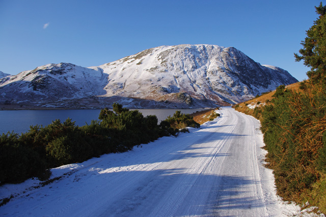
| current | 19:14, 25 March 2010 | | 640 × 425 (149 KB) | Bob@romiley1 (talk | contribs) | '''Crummock Water and Mellbreak'''<br/>The B5289 alongside Crummock Water. <br /> Mellbreak (NY1418) is in the distance.<br /> See <a href="http://www.geograph.org.uk/photo/441427">NY1617 : The banks of Crummock Water with Mellbreak in the background</a |
File usage
The following page uses this file: