File:Cullingworth Viaduct - Geograph - 38299.jpg

From Roader's Digest: The SABRE Wiki
Jump to navigation Jump to search

Cullingworth_Viaduct_-_Geograph_-_38299.jpg(640 × 480 pixels, file size: 158 KB, MIME type: image/jpeg)

Y topleft.gifY topright.gif
Description:
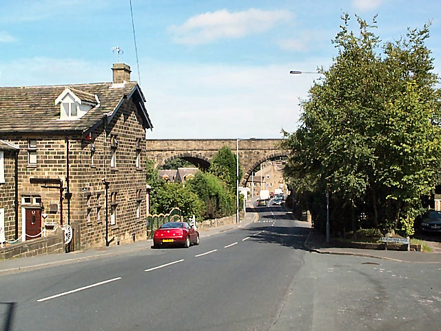
Cullingworth Viaduct
At the southern end of the village, the long disused Great Northern viaduct crosses Haworth Road (the B6144 towards Bradford). The junction of the B6144 and the B6429 can be seen beyond. Cullingworth was on the Queensbury to Keighley line. The route has recently been opened to cyclists and pedestrians as part of the National Cycle Network.
Location:53.822931, -1.900919
Road:b6144
Date:15 08 2005
Photographer:� Copyright David Spencer and licensed for reuse under this Creative Commons Licence
Source:Geograph

Map

Y btmleft.gifY btmright.gif

Galleries  | b6144 | S2

File history

Click on a date/time to view the file as it appeared at that time.

Date/TimeThumbnailDimensionsUserComment
current15:05, 2 April 2010Thumbnail for version as of 15:05, 2 April 2010640 × 480 (158 KB)Bob@romiley1 (talk | contribs)'''Cullingworth Viaduct'''<br/>At the southern end of the village, the long disused Great Northern viaduct crosses Haworth Road (the B6144 towards Bradford). The junction of the B6144 and the B6429 can be seen beyond. Cullingworth was on the Queensbury t

The following 3 pages use this file:

Metadata

SABRE - The Society for All British and Irish Road Enthusiasts
Discuss - Digest - Discover - Help