File:Darlington Inner Ring Road Complete.png
Jump to navigation
Jump to search

Size of this preview: 557 × 600 pixels. Other resolution: 1,114 × 1,200 pixels.
Original file (1,114 × 1,200 pixels, file size: 282 KB, MIME type: image/png)
| |||||||||||||||||||||||||
|
Galleries | A68 | A167 | Darlington | ||
File history
Click on a date/time to view the file as it appeared at that time.
| Date/Time | Thumbnail | Dimensions | User | Comment | |
|---|---|---|---|---|---|
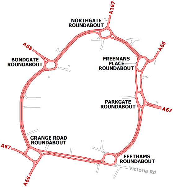
| current | 20:29, 6 June 2020 | | 1,114 × 1,200 (282 KB) | Truvelo (talk | contribs) | The complete Darlington Inner Ring Road as planned in the early 1970's. The western side would have been the final stage which was never built. This map shows the remainder of the road as originally built. The three roundabouts on the eastern side have been altered in the intervening years with Parkgate Roundabout becoming a set of traffic lights in 2014. |
File usage
The following page uses this file: