File:Delph Bridge (High Street) (C) David Dixon - Geograph - 2257399.jpg
Jump to navigation
Jump to search

No higher resolution available.
Delph_Bridge_(High_Street)_(C)_David_Dixon_-_Geograph_-_2257399.jpg (640 × 480 pixels, file size: 89 KB, MIME type: image/jpeg)
| |||||||||||||||||||||||||
|
Galleries | A62 | Delph Bridge | ||
File history
Click on a date/time to view the file as it appeared at that time.
| Date/Time | Thumbnail | Dimensions | User | Comment | |
|---|---|---|---|---|---|
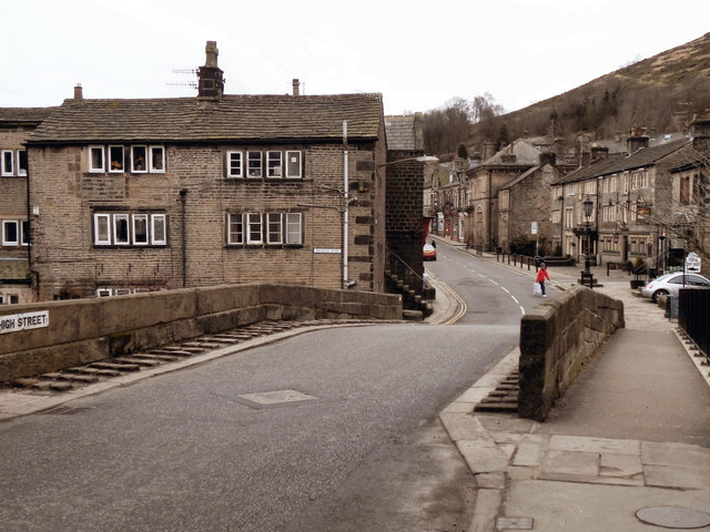
| current | 15:22, 31 October 2014 | | 640 × 480 (89 KB) | Jeni (talk | contribs) | '''Delph Bridge (High Street) (C) David Dixon '''<br/>A view across the Grade II listed, 18th century humped bridge across the River Tame at Delph. The footway on the right hand side is a twentieth century addition, made necessary by the increased vehi... |
File usage
The following page uses this file:
_(C)_David_Dixon_-_Geograph_-_2257399.jpg&oldid=390054)