File:Downham Bridge - Geograph - 1834258.jpg

From Roader's Digest: The SABRE Wiki
Jump to navigation Jump to search

Downham_Bridge_-_Geograph_-_1834258.jpg(640 × 434 pixels, file size: 90 KB, MIME type: image/jpeg)

Y topleft.gifY topright.gif
Description:
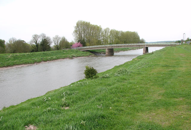
Downham Bridge
Downham Bridge takes the A1122 (Bridge Road) over the River Great Ouse. This view was taken from the Fen Rivers Way. The Fen Rivers Way is a 50 mile long distance footpath leading from King's Lynn to Cambridge, via Downham Market, Denver Sluice and Ely. It follows the course of the well-drained floodbanks of the rivers Great Ouse and Cam for most its way. A ferry links it with the Peter Scott Walk at King's Lynn.
Location:52.600421, 0.356622
Road:A1122
Date:28 04 2010
Photographer:� Copyright Evelyn Simak and licensed for reuse under this Creative Commons Licence
Source:Geograph

Map

Y btmleft.gifY btmright.gif

Galleries  | A1122 | Downham Market | Downham Bridge

File history

Click on a date/time to view the file as it appeared at that time.

Date/TimeThumbnailDimensionsUserComment
current16:32, 21 June 2010Thumbnail for version as of 16:32, 21 June 2010640 × 434 (90 KB)Bob@romiley1 (talk | contribs)'''Downham Bridge'''<br/>Downham Bridge takes the A1122 (Bridge Road) over the River Great Ouse. This view was taken from the Fen Rivers Way. The Fen Rivers Way is a 50 mile long distance footpath leading from King's Lynn to Cambridge, via Downham Market,

Metadata

SABRE - The Society for All British and Irish Road Enthusiasts
Discuss - Digest - Discover - Help