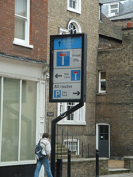
File:Electronic sign in Trumpington Street northbound, Cambridge, just south of junction with Mill Lane (shown as dead end), and Pembroke Street - Coppermine - 5033.jpg
Jump to navigation
Jump to search

Size of this preview: 450 × 600 pixels. Other resolution: 960 × 1,280 pixels.
Original file (960 × 1,280 pixels, file size: 261 KB, MIME type: image/jpeg)
| |||||||||||||||||||||||||
|
Galleries | Unclassified | Sign | Cambridge | ||
File history
Click on a date/time to view the file as it appeared at that time.
| Date/Time | Thumbnail | Dimensions | User | Comment | |
|---|---|---|---|---|---|
| current | 12:32, 7 July 2010 | | 960 × 1,280 (261 KB) | Bob@romiley1 (talk | contribs) | '''Electronic sign in Trumpington Street northbound, Cambridge, just south of junction with Mill Lane (shown as dead end), and Pembroke Street''' Ahead there are two Bus/Cycle/Pedestrian areas: "Queens" means Quuens College, either side of Silver Street, |
File usage
There are no pages that use this file.
,_and_Pembroke_Street_-_Coppermine_-_5033.jpg&oldid=408962)