File:Essex Way, Benfleet, from the top of the hill - Geograph - 1599482.jpg

From Roader's Digest: The SABRE Wiki
Jump to navigation Jump to search

Essex_Way,_Benfleet,_from_the_top_of_the_hill_-_Geograph_-_1599482.jpg(640 × 427 pixels, file size: 76 KB, MIME type: image/jpeg)

Y topleft.gifY topright.gif
Description:
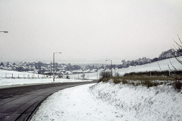
Essex Way, Benfleet, from the top of the hill
Essex Way runs from South Benfleet, near the station, to the Water Tower at the top of the hill. It is one of the few roads in Benfleet with open fields on either side. This photo was taken in December 1970, just after we moved into South Benfleet. <a href='http://www.geograph.org.uk/photo/1599479'>TQ7886 : Essex Way, Benfleet, from the bottom of the hill</a> shows Essex Way from the opposite direction.
Location:51.546555, 0.572635
Road:B1014
Date:20 12 1970
Photographer:� Copyright John Rostron and licensed for reuse under this Creative Commons Licence
Source:Geograph

Map

Y btmleft.gifY btmright.gif

Galleries  | B1014

File history

Click on a date/time to view the file as it appeared at that time.

Date/TimeThumbnailDimensionsUserComment
current00:41, 15 March 2010Thumbnail for version as of 00:41, 15 March 2010640 × 427 (76 KB)Jeni (talk | contribs)'''Essex Way, Benfleet, from the top of the hill'''<br/>Essex Way runs from South Benfleet, near the station, to the Water Tower at the top of the hill. It is one of the few roads in Benfleet with open fields on either side. This photo was taken in Decemb

The following page uses this file:

Metadata

SABRE - The Society for All British and Irish Road Enthusiasts
Discuss - Digest - Discover - Help