 | |  |
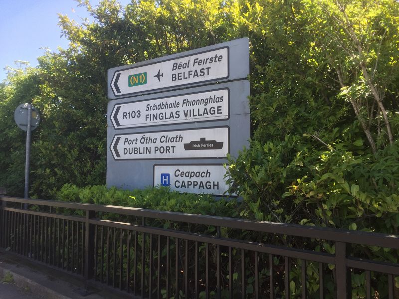
| | Description: | A large sign in Finglas referring to the N1, and naming Irish Ferries, despite being some distance from both. | | Location: | 53.389938, -6.300977 | | Road: | R103 | | Date: | 06 05 2020 | | Photographer: | Johnathan404 | | Source: | Own work |
|
|
| |
 | |  |
File history
Click on a date/time to view the file as it appeared at that time.
| Date/Time | Thumbnail | Dimensions | User | Comment |
|---|
| current | 00:44, 18 May 2020 |  | 2,000 × 1,500 (898 KB) | Johnathan404 (talk | contribs) | A large sign in Finglas referring to the N1, and naming Irish Ferries, despite being some distance from both. |
File usage
There are no pages that use this file.
This file contains additional information, probably added from the digital camera or scanner used to create or digitise it.
If the file has been modified from its original state, some details may not fully reflect the modified file.
