File:Flash flood in Star Road - Geograph - 1110858.jpg

From Roader's Digest: The SABRE Wiki
Jump to navigation Jump to search

Flash_flood_in_Star_Road_-_Geograph_-_1110858.jpg(640 × 480 pixels, file size: 84 KB, MIME type: image/jpeg)

Y topleft.gifY topright.gif
Description:
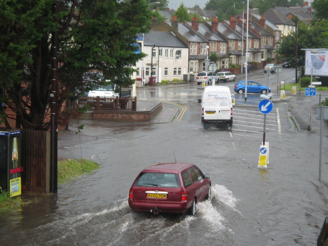
Flash flood in Star Road
Flash flood in Star Road, Caversham. Photo was taken from the upper part of Star Road (north) and looking north towards the Star Inn and the junction with Briants Avenue, Donkin Hill, Lower Henley Road, and Southview Avenue.
Location:51.468086, -0.959100
Road:B3345
Date:20 07 2007
Photographer:� Copyright Karen Blakeman and licensed for reuse under this Creative Commons Licence
Source:Geograph

Map

Y btmleft.gifY btmright.gif

Galleries  | B3345

File history

Click on a date/time to view the file as it appeared at that time.

Date/TimeThumbnailDimensionsUserComment
current16:48, 8 March 2010Thumbnail for version as of 16:48, 8 March 2010640 × 480 (84 KB)Jeni (talk | contribs)'''Flash flood in Star Road'''<br/>Flash flood in Star Road, Caversham. Photo was taken from the upper part of Star Road (north) and looking north towards the Star Inn and the junction with Briants Avenue, Donkin Hill, Lower Henley Road, and Southview Ave

The following page uses this file:

Metadata

SABRE - The Society for All British and Irish Road Enthusiasts
Discuss - Digest - Discover - Help