File:Fleet Road, Fleet (C) Darren Smith - Geograph - 17028.jpg

From Roader's Digest: The SABRE Wiki
Jump to navigation Jump to search

Fleet_Road,_Fleet_(C)_Darren_Smith_-_Geograph_-_17028.jpg(640 × 480 pixels, file size: 94 KB, MIME type: image/jpeg)

Y topleft.gifY topright.gif
Description:
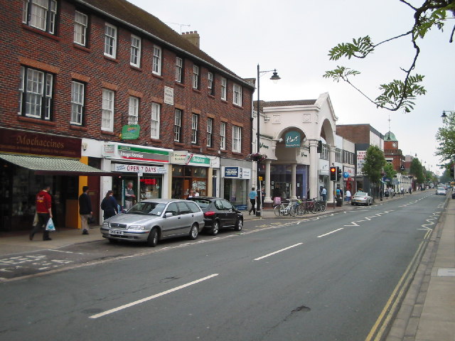
Fleet Road, Fleet (C) Darren Smith
This is Fleet's main shopping street. On the left are the buildings of 'Royal Parade', constructed in 1939 according to the plaque. To the right is one of the entrances to Hart Shopping Centre, Fleet's modern shopping arcade.
Location:51.280322, -0.842911
Road:A3013
Date:10 06 2005
Photographer:Darren Smith and licensed for reuse under this Creative Commons Licence
Source:Geograph

Map

Y btmleft.gifY btmright.gif

Galleries  | A3013

File history

Click on a date/time to view the file as it appeared at that time.

Date/TimeThumbnailDimensionsUserComment
current19:58, 7 July 2014Thumbnail for version as of 19:58, 7 July 2014640 × 480 (94 KB)Vlad (talk | contribs)'''Fleet Road, Fleet (C) Darren Smith '''<br/>This is Fleet's main shopping street. On the left are the buildings of "Royal Parade", constructed in 1939 according to the plaque. To the right is one of the entrances to Hart Shopping Centre, Fleet's mode...

The following 2 pages use this file:

Metadata

SABRE - The Society for All British and Irish Road Enthusiasts
Discuss - Digest - Discover - Help