File:Folkestone Harbour 1980 - Geograph - 63040.jpg
Jump to navigation
Jump to search


Size of this preview: 383 × 599 pixels. Other resolution: 409 × 640 pixels.
Original file (409 × 640 pixels, file size: 118 KB, MIME type: image/jpeg)
| |||||||||||||||||||||||||
|
Galleries | A260 | Folkestone - Boulogne ferry | ||
File history
Click on a date/time to view the file as it appeared at that time.
| Date/Time | Thumbnail | Dimensions | User | Comment | |
|---|---|---|---|---|---|
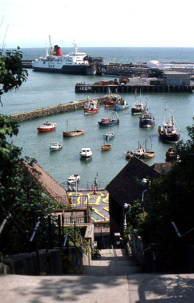
| current | 11:16, 8 July 2010 | | 409 × 640 (118 KB) | Abeaton (talk | contribs) | '''Folkestone Harbour 1980'''<br/>Taken in 1980 when regular cross channel ferries operated out of Folkestone. |
File usage
The following 3 pages use this file: